Softwares

L'aspettiamo!
Live Support
Acquisto sicuro degli attrezzi da fitness
SSL gesichtert
Il Suo ordine é cifrato con 256-twlg -SSL
Trova la filiale
Filialen

Softwares

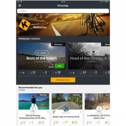
Con un Training Software aumentano varieta e motivazione durante il training. Assieme ad un computer e ad un collegamento ad Internet, il Training Software adeguato da accesso ad un modo straordinario di allenarsi. A seconda del Software ci si allena sulle strade del mondo, ci si incontra con amici per una gara o si analizza il proprio training.
Assortimento:
Articoli per pagina:
Produttore:
1 2 3
/magicmaps/magic_maps_interaktive_karten_001_u.jpg

MagicMaps Interactive maps DVD Version 1.5


ArtNr. MM-1043-V15
The MagicMaps Interactive maps DVD Version 1.5 offers a vast 2D map illustration of the German states. Plan comfortably your tours on the pc with the MagicMaps Interactive maps DVD Version 1.5 and transmit your routes to your GPS device. Height differences are considered as well. The Magic Maps software is equiped with a position data base, so that your targets are found rapidly and comfortably. You can even use your tours with the Kettler Ergo Konzept II training software using an update of the MagicMaps website.
  • Comfortable tour planning of MagicMaps
  • 1 to 2 states per DVD
  • Sheet lines-free 2 D map 1:25.000
  • Compile and work on own tours
  • Print maps and profiles to scale
  • Using an update of the Magic Maps website, your tours can also be transmitted to the Kettler Ergo Konzept II training software. You can even cycle your tours at home !
  • Varianti disponibili: Hessen, Rheinland-Pfalz/ Saarland, Schleswig-Holstein/ Hamburg , Brandeburg/ Berlin, Mecklenburg-Vorpommern, Sachsen, Thüringen
Version 1.5 EUR 15,90
EUR 44,90
piú invio
Subito disponibile!
Solo fino ad esaurimento scorta!
/magicmaps/interaktivekarten_deutschland_m.jpg

MagicMaps DVD Interactive Maps


ArtNr. MM-1033
The interactive maps contain comprehensive 2D and 3D maps of all German states. The interactive maps can be used e.g. for tour planning, display of GPS data or in combination with the Kettler Ergo Konzept II to control your Kettler fitness machine.
  • Per DVD 1-2 states, some states divided on two DVDs
  • based on the official topographical maps, scale 1:25.000
  • digital 3D terrain model
  • comprehensive functions and applications, e.g.:
  • NEW: free of sheet lines, interaktive 3D-panorama portrayal (screen width 50 m)
  • NEW: automatically flying above the tour in 3D
  • the interface to the Kettler Ergo Konzept II enables you to train with self-defined tours on your Kettler machine
  • interface to transfer tour and waypoint data to and from the Suunto X9i
  • interface for evaluation of Ciclosport HAC4 pulse and cadence data with the interactive maps
  • menu language: German
  • Varianti disponibili: Baden-Württemberg Süd, Baden-Württemberg Nord, Brandenburg/Berlin, Hessen, Mecklenburg-Vorpommern, Nordrhein-Westfalen West, Nordrhein-Westfalen Ost, Rheinland-Pfalz/Saarland, Sachsen, Schleswig-Holstein/Hamburg, Thüringen
Version 2.0 EUR 19,90
EUR 49,90
piú invio
Subito disponibile!
/magicmaps/interaktivekarten_deutschland_m.jpg

MagicMaps Interaktive Karten DVD-Set


ArtNr. MM-1038
The interaktive maps contain large-scale 2D- and 3D-map descriptions of all Federal States. These can be used, e. g., for tour planning, description of GPS-data or in combination with the Kettler Ergo Konzept II for zur controlling your Kettler fitness tool.
  • Set consisting of 2 DVDs of larger states
  • based on the official topographical maps, scale 1:25.000
  • digital 3D terrain model
  • comprehensive functions and applications, e.g.:
  • NEW: free of sheet lines, interaktive 3D-panorama description (screen width 50 m)
  • NEW: fly automatically over the tours in 3D
  • the interface to the Kettler Ergo Konzept II enables you to train with self-defined tours on your Kettler machine
  • interface to transfer tour and waypoint data to and from the Suunto X9i
  • interface for evaluation of Ciclosport HAC4 pulse and cadence data with the interactive maps
  • menu language: German
  • Varianti disponibili: Baden-Württemberg (Nord + Süd), Bayern (Nord + Süd), Niedersachsen/Bremen (West + O, Nordrhein-Westfalen (West + Os
Version 2.0 EUR 29,90
EUR 79,90
piú invio
Subito disponibile!
Solo fino ad esaurimento scorta!
/magicmaps/tour_explorer_bundeslaender_m.jpg

MagicMaps Tour Explorer DVD


ArtNr. MM-1083
The Tour Explorer DVDs are the ideal tool for planing your leasure activities. It contains comprehensive 2D and 3D maps of all German states and provides many functions for the planning of tours.
  • Plan, create and analyse tours
  • No sheet line, official, topographic maps, scale 1:25.000 in 2D and 3D
  • NEW: Tour planning using the ADFC cycle path network by entering starting point, finishing point and waypoints
  • Interactive 3D flight across the landscape
  • NEW: Object manager for managing, storing and archiving your tour projects now organised in a straightforward way
  • Direct GPS interface for the import/export of tracks, routes and waypoints to GPS devices by Garmin and Magellan
  • Programme language: German
  • Varianti disponibili: Bayern, Baden-Württemberg, Nordrhein-Westfalen, Niedersachsen/Bremen, Hessen/Rheinl.-Pfalz/Saarland, Schl.-H./Hamburg/Meckl.-Vorp., Berlin/Brandenburg/Sachs.-Anh.
3.0 version EUR 29,90
EUR 49,90
piú invio
Subito disponibile!
Solo fino ad esaurimento scorta!
/magicmaps/interaktivekarten_oesterreich_m.jpg

MagicMaps interactive maps Austria


ArtNr. MM-2002
The interactive maps contain comprehensive 2D and 3D maps of all German states. The interactive maps can be used e.g. for tour planning, display of GPS data or in combination with the Kettler Ergo Konzept II to control your Kettler fitness machine.
  • map material based on official topographic maps in scale of 1:50.000 by the Federal Office for Metrology and Surveying, Vienna.
  • with a lot of tools and prepared tour recommendations
  • comprehensive functions and applications, e.g.:
  • NEW: free of sheet line, interactive 3D-panorama description (screen width 50 m)
  • NEW: fly automatically over the tours in 3D
  • the interface to the Kettler Ergo Konzept II enables you to train with self-defined tours on your Kettler machine
  • interface to transfer tour and waypoint data to and from the Suunto X9i
  • interface for evaluation of Ciclosport HAC4 pulse and cadence data with the interactive maps
  • menu language: German
EUR 29,90
EUR 79,90
piú invio
Subito disponibile!
Solo fino ad esaurimento scorta!
/ciclosport/interfaceusb.gif

Ciclosport HACtronic Pro


ArtNr. 10302110
Interfaccia-PC e due programmi per l´evaluazione e la preparazione dell´allenamento al computer, come anche per pianificare le gite.
  • Interfaccia PC con porta USB
  • Software HACtronic per l´evaluazione dei dati
  • Pianificatore CicloTour per preparare le gite ed escursioni
EUR 39,90
EUR 89,99
piú invio
Subito disponibile!
Solo fino ad esaurimento scorta!
/magicmaps/tour_explorer_deutschlandgesamt_m.jpg

MagicMaps Tour Explorer DVD


ArtNr. MM-1102
The Tour Explorer DVDs are the ideal tool for planing your leasure activities. It contains comprehensive 2D and 3D maps of all German states and provides many functions for the planning of tours.
  • Northern Germany includes: Lower Saxony/Bremen, Schleswig-Holstein/Hamburg/ Mecklenburg-Western Pomerania
  • Eastern Germany includes: Berlin/Brandenburg/Saxony, Saxony-Anhalt/Thuringia
  • Western Germany includes: North Rhine-Westphalia, Hesse/Rhineland-Palatinate/Saarland
  • Southern Germany includes: Bavaria, Baden-Wuerttemberg
  • Plan, create and analyse tours
  • No sheet line, official, topographic maps, scale 1:25.000 in 2D and 3D
  • Easy user guidance with detailed help menue
  • NEW: Tour planning using the ADFC cycle path network by entering starting point, finishing point and waypoints
  • Interactive 3D flight across the landscape
  • NEW: Object manager for managing, storing and archiving your tour projects now organised in a straightforward way
  • Direct GPS interface for the import/export of tracks, routes and waypoints to GPS devices by Garmin and Magellan
  • Programme language: German
  • Varianti disponibili: Deutschland Nord, Deutschland Ost, Deutschland West
3.0 version EUR 39,90
EUR 79,90
piú invio
Subito disponibile!
Solo fino ad esaurimento scorta!
/magicmaps/tour_explorer_deutschlandgesamt_m.jpg

MagicMaps Tour Explorer DVD


ArtNr. MM-1106
La collezione di DVD Tour Explorer é lo strumento ideale per l'organizzazione del Suo tempo libero. Questo contiene numerose 2D- e 3D-mappe di tutte le regioni della Germania e offre molte funzioni per la pianificazione dei propri Touren.
  • Germania del nord comprende: Renania Settentrionale-Vestfalia, Bassa Sassonia/Brema, Schleswig-Holstein/Amburgo, Melemburgo-Pomerania, Sassonia-Anhalt, Brandeburgo/Berlino
  • Germania del sud comprende: Baviera, Baden-Württemberg, Assia, Renania-Palatinato, Territorio della Saar, Turingia, Sassonia
  • Touren pianificare, eseguire e valutare
  • Cartina topografica ufficiale senza taglio in scala da 1:25.000 con rappresentazione in 2D e 3D
  • Semplici istruzioni d'uso con vasto menú di aiuto
  • NUOVO: pianificazione del percorso sulla rete dei percorsi ciclistici ADFC attraverso l'inserrimento della partenza, dell'obiettivo e delle tappe
  • Pilotaggio aereo interattivo in 3D sopra il paesaggio
  • NUOVO: Object manager per la gestione, memorizzazione ed archiviazione dei Suoi progetti di itinerario, adesso con struttura dell'ordine ben visibile
  • Interfaccia diretto GPS per l' Import / Export di Tracks, percorsi e way points su attrezzi GPS dal Garmin e Magellan
  • Lingua del programma: tedesco
  • Varianti disponibili: Germania del nord, Germania del sud
Versione 3.0 EUR 49,90
EUR 129,90
piú invio
Subito disponibile!
Solo fino ad esaurimento scorta!
/magicmaps/interaktivekarten_schweiz_m.jpg

MagicMaps Interactive Cards Svizzera


ArtNr. MM-2003
Le carte topografiche interattive contengono diverse rappresentazioni digitali dei cantoni, sia bi- che tridimensionale. Esse possono venir utilizzate per la pianificazione di determinati percorsi, per la rappresentazione dei dati GPS ovvero in concomitanza con il Kettler Ergo Konzept II .
  • materiale basantesi su cartine topografiche ufficiali in scala 1:50.000
  • contiene anche consigli preparati per la creazione di giri presonali
  • ampie funzioni e possibilità d'uso :
  • NOVITÀ: rappresentazione panoramica interattiva senza salti di grafica (quadratura 50 m)
  • portale aperto verso il Kettler Ergo Konzept II consente l'allenamento su percorsi autodefiniti
  • portale per connessione a/da Suunto X9i
  • portale per la valutazione di pulsazione e cadenza registrati usando il Ciclosport HAC4 con le carte interattive
  • NOVITÀ: versione multilinguale in tedesco, inglese, francese ed italiano
  • Varianti disponibili: Zurigo, Unterengadin/Mittelbü, Oberengadin, Berna, Lucerna/Vierwaldstättersee, Gotthard/Bündner , Berner Oberland
EUR 49,90
EUR 89,90
piú invio
Subito disponibile!
/sporttiedje/st_usb_online_training_001_u.jpg

Sport-Tiedje USB-Kit Online Training


ArtNr. ST-OT-USB10 Modello 2012
Lo Sport-Tiedje Online Training funge da Trainer per un controllo innovativo della salute e del Fitness, ed offre consigli ed assistenza per il raggiungimento degli scopi personali. Inoltre lo Sport-Tiedje Trainingssoftware crea piani di allenamento adeguati alle proprie esigenze con chiare indicazioni su frequenza, durata ed intensitá con cui ci si deve allenare, per raggiungere nel modo migliore gli scopi prefissati. Un'ulteriore innovazione dello Sport-Tiedje Health- and Fitnessmanagement é l'uso dello Sport-Tiedje USB-Sticks come mezzo di memorizzazione. Questo collegato ad un attrezzo certificato Sport-Tiedje Online Training fa si che i risultati di allenamento vengano registrati automaticamente sullo Stick-USB. Alla fine del Training gli stessi possono essere trasmessi via Internet su Sport-Tiedje Onlineprofil. Lo Sport-Tiedje Online Trainingssoftware é integrato con altri utili Tools come ad esempio un calcolatore di calorie, un diario per il Training e l'alimentazione.
  • Compreso nella consegna: Sport-Tiedje USB-KIT + Login-Code per la registrazione per lo Sport-Tiedje Online Training!
  • Utile per tutti gli attrezzi certificati Sport-Tiedje Online Training (anche per gli attrezzi cardiostrong).
  • Piano di Training individuale per resistenza, forza e flessibilitá
  • Memorizzazione, valutazione e archiviazione automatiche di tutti i dati del Training!
  • Gestione utente panoramica e facile
EUR 49,90
piú invio
Subito disponibile!
Articolo visualizzato: 1 fino a 10 di 23
1 2 3
Ultimi visti (30)
  • MagicMaps Interactive Cards Svizzera
    MM-2003
  • MagicMaps DVD Interactive Maps
    MM-1033
  • Lonsdale Guantone Professional Contest
    LO-L1-8
  • Lifefitness Ergometro Orizzontale R3 Advanced
    LFLC-R3-ADV
  • Lifefitness Crosstrainer X5 Advanced
    LCT-X5-ADVANCED
  • Lifefitness Crosstrainer X1 Basic
    LCT-X1-BAS
  • Lifefitness Crosstrainer Club Series CSX
    LCT-CSX
  • LeMond Indoorcycle RevMaster Pro
    LM-15300
  • Pad Silent Spike LEKI
    LEK-882300103
  • LEKI Walker XS
    LEK-2653
  • Flash Carbon della LEKI
    LEK-2530T3
  • Instructor della LEKI
    LEK-2632
  • Sport-Tiedje Dischi 3G
    TI0050-3G
  • Kettler Allena dorsali Vital
    7820-400
  • Kettler Variogym
    7819-600
  • Kettler Piantana universale SELECTION
    7499-500
  • Kettler Powercenter Ultra Pro E
    7714-300
  • Kettler Trampolino 95cm
    7290-900
  • Cyclette Kettler Topas 2006
    7942-600
  • Kettler Tavolo da Ping Pong Match 3.0 Outdoor
    7175-500
  • Kettler Tavolo da Ping-Pong Stockholm
    7162-500
  • Kettler Side Stepper
    7874-700
  • Kettler Corda da salto Soft
    7287-600
  • Kettler Spray Silicone Top Glide
    43008001
  • Kettler asse per altalena
    8396-960
  • Kettler vogatore Ergocoach LS
    7985-850
  • Kettler Vogatore Coach LS
    7985-640
  • Cyclette Kettler Racer 2005
    7938-400
  • Kettler Cardio Puls set
    7937-600
  • Kettler Curlpult-bicipite per Primus 100
    7465-880